
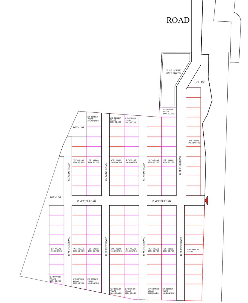

An incredibly lifelike, richly detailed, photorealistic floorplan photo of a planned residential development set in a sprawling, well-organized layout. The scene is illuminated by a neutral, overhead lighting, creating a functional and informative atmosphere, as if viewed from directly above by an architectural drone. Captured with a high-resolution, wide-angle lens, emphasizing the precise dimensions and spatial relationships of the property, highlighting the clearly defined plot boundaries and road networks. Each parcel is rendered with a distinct color coding, indicating different zones or types of dwellings, with detailed inscriptions of "W.F. VILLAS," "E.F. CORNER VILLAS," and their respective square yardage visible upon close inspection. A prominent "ROAD" and "CLUB HOUSE 1821.6 SQYDS" are clearly indicated, adding context to the planned community. The meticulous grid-like arrangement of plots and the clear delineation of "10 M WIDE ROAD" and "12 M WIDE ROAD" suggest a modern, systematic approach to urban planning, where every detail contributes to the overall understanding of the development's scale and structure.