伊斯兰波斯
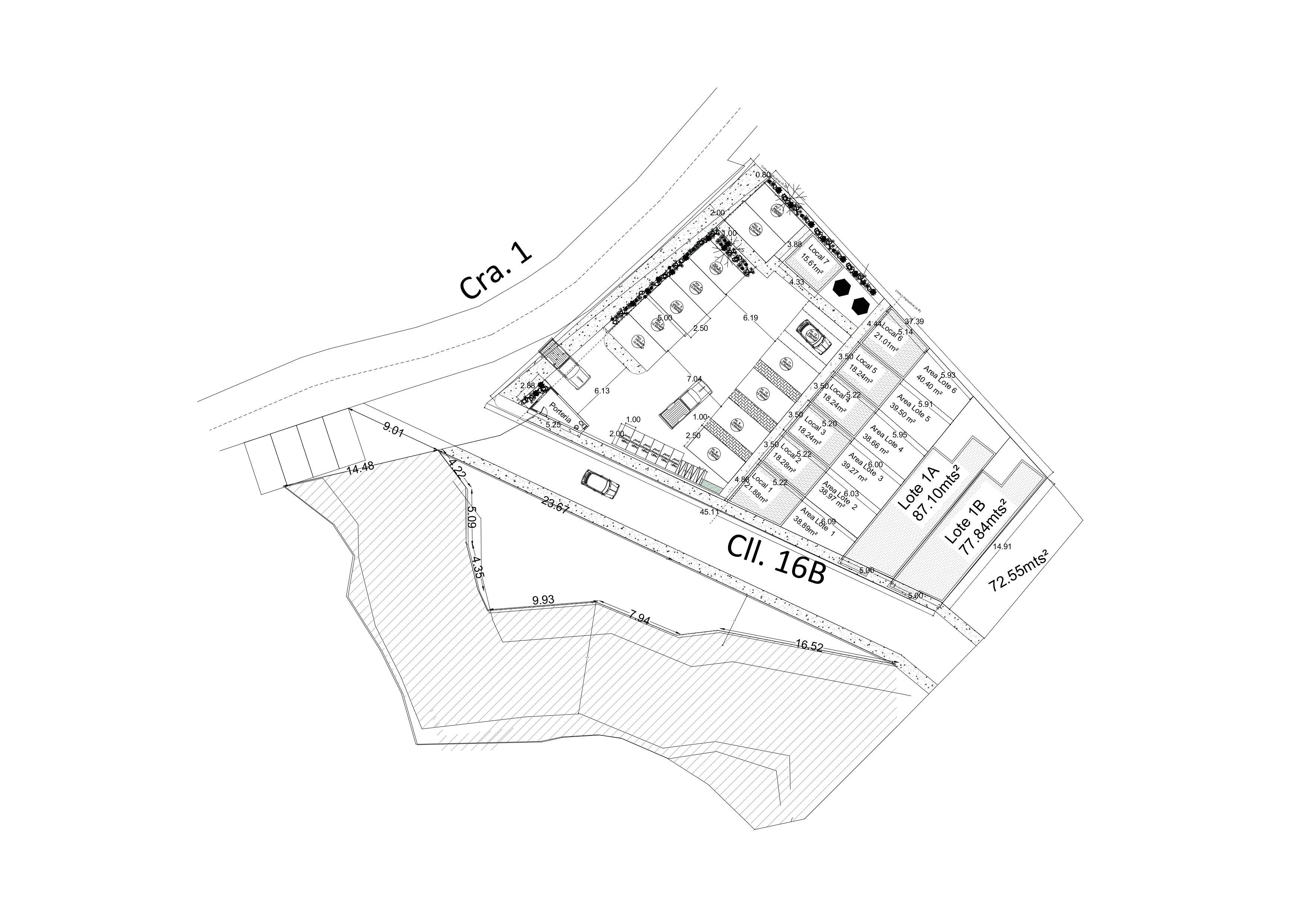
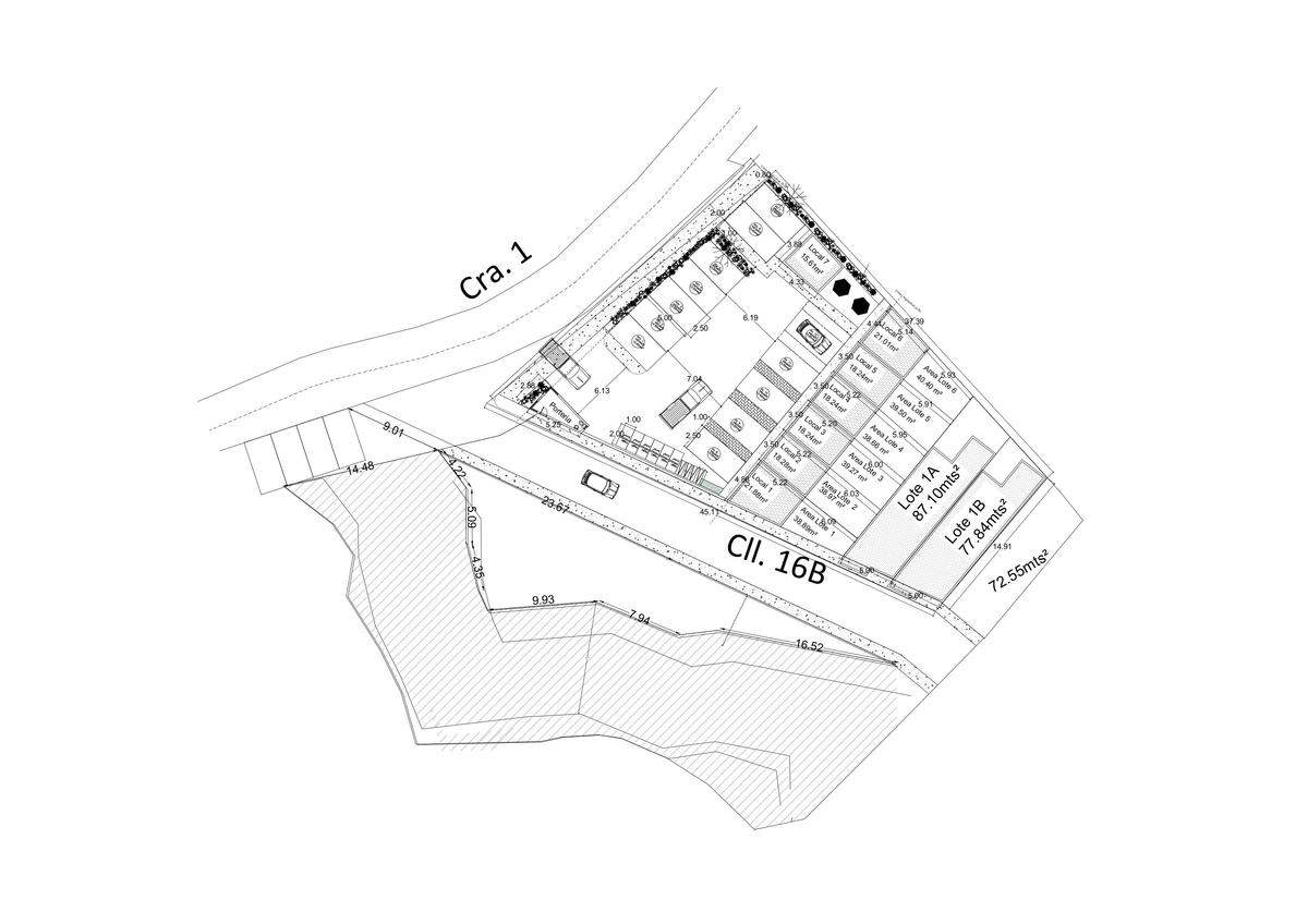

An incredibly lifelike, richly detailed, photorealistic floorplan photo of a modern residential complex and its surrounding landscape. The scene is illuminated by bright, even daylight, suggesting an overhead aerial view, creating a clear and informative atmosphere. Captured with a high-resolution drone lens, emphasizing sharp lines and precise spatial relationships, the photograph showcases a cluster of buildings arranged around a central courtyard. Each building is meticulously detailed with individual units labeled as "Local" and indicated with floor areas, hinting at a multi-unit dwelling. The complex is divided into plot areas designated as "Lote 1A" and "Lote 1B," with their respective square meterages clearly marked, indicating planned development. A main road, "Cra. 1," runs along the top of the frame, bordered by a dashed line suggesting a pedestrian path. Another road, "CII. 16B," runs parallel to the development. The terrain slopes downwards on the left and front of the complex, indicated by hatched lines denoting the changes in elevation, with measurements like "9.01" and "14.48" providing topographical context. Several cars are neatly parked within the complex, adding a sense of occupancy, and architectural details like "Porteria" (gatehouse) are visible. Greenery is suggested in some areas with small circular icons, implying landscaped spaces. The overall composition highlights the meticulous planning and layout of the residential project, offering a comprehensive overview of its structure and environment.